


Part IThe Story
Three Hundred Trees
In the spring of 1970, a few months after he came home from Harvard with a master's degree and an idea no one would fund, Jack Dangermond drew a planting plan for an elementary school. Kingsbury School stood in Redlands, California, the town east of Los Angeles where his Dutch immigrant parents ran a plant nursery. It was also the town he had been expected to outgrow, and he had come back to it anyway. The design called for three hundred trees. He donated it. On April 20, 1970, the Redlands Daily Facts reported on page six that the Redlands Horticultural and Improvement Society had voted to send him a letter of appreciation. The item ran inside a story whose headline concerned a lecture on daffodils. In May the trees went into the ground.
Nobody at the Horticultural and Improvement Society could have known what else the young landscape architect was doing that spring. In a storefront a short drive away, he and his wife, Laura, were trying to keep alive something they had named, with an ambition wildly out of proportion to its bank balance, the Environmental Systems Research Institute. Its work was to translate landscapes into numbers and stack them in a computer, one transparent layer on another: soils on slopes on watersheds on roads on zoning. The computer then reported where a town could go, or a power plant, or nothing at all. So the same man was working on two scales that season. At one he was making a list of saplings for a schoolyard. At the other he was building the beginning of an abstraction that would, half a century on, let 150 million new maps be made every day by the people who used his software.
Those two activities never separated in him, which is the odd part. One is tending a particular piece of ground. The other is flattening the whole planet into layers of data. He has spent fifty-seven years in the same small city, and from there he built the instrument that governments, armies, oil companies, conservationists, epidemiologists and Starbucks use to understand everywhere else. Esri's headquarters are at 380 New York Street, in Redlands. That the world's dominant mapmaker has an address named for a city three thousand miles away is the kind of joke geography makes all the time, and nobody in Redlands seems to find it very funny.
He is eighty-one now. As of April 2026, Forbes put his net worth at $13.4 billion, and he has told reporters that landing on its lists of tech billionaires makes him cringe. He still goes to the office every day. So, reportedly, does Laura, who according to an Esri employee still signs every paycheck. Esri has never taken venture capital, never gone public, and never carried debt. It has never conducted large-scale layoffs. Its founders have been giving the product away to schools and nonprofits for decades, and in 2017 they gave away a stretch of the California coast.
Men with fortunes that size are not usually this dull, or this consistent, and the consistency is the puzzle. Dangermond has told the story of his life the same way for fifty years, often in the same phrases, as though reading from a text he settled on long ago. A magazine writer once observed that he "tends to speak as if in final draft," a habit Dangermond credits to years of dictating correspondence. The hard part is working out what the draft leaves out.
By the Numbers
The Company That Never Left Redlands
$5,000Loan from his mother — reportedly the only outside money Esri ever took
~$2BApproximate annual revenue, per Dangermond in 2025
30%Share of annual revenue reinvested in research and development
43–45%Esri's share of the global GIS software market
16 → 31,590Attendees at the first user conference (1981) versus 2022, from 142 countries
$165MGift to The Nature Conservancy for the Dangermond Preserve, the largest in its history
$0Corporate debt carried by the company
A Gardener and a Maid
His father came from Holland. That is how Dangermond tells it, in the plain order of a man listing facts he expects you to take in without ornament: "My father came from Holland, and he married a second-generation Dutch lady here. He was a gardener and she was a maid. So they started a nursery." The father was Peter Dangermond Sr. The mother was Alice Meines. Dangermond's Nursery grew up in Redlands on what a gardener and a maid could save, and in December 1981 the Redlands Daily Facts ran the notice: Peter Dangermond Sr., founder of nursery, dies at age 79. By then his son's company had held its first user conference on its own grounds, with sixteen people in attendance.
Paul Jacob Dangermond was born in the summer of 1945, at the hospital in neighboring Loma Linda. He went by Jack and worked at the nursery through his teens, and by the account the Library of American Landscape History later assembled, he learned every part of the business. He learned the finances and the care of plants, and he went out on landscape jobs with the nursery crews. Asked decades later what that upbringing gave him, he reduced it to two verbs: it "was learning how to grow things, how to sell things." Then he added the sentence that explains most of what followed: "It gave me a foundation for what I do today but at a much broader scale."
Dangermond likes that idea of the same work at a broader scale, and he returns to it. In 2015 he told a radio reporter, laughing, that people hear the word geodesign and assume it's "a thing for artsy people." "No," he said, "farmers do geodesign. They bring in geographic science and they lay out the design for what they're going to grow. It's problem-solving in a spatial domain." Seen this way, the nursery was a small spatial system of its own. Sun and shade, soil and drainage, which shrub goes where so that it lives. A good nurseryman carries a map of microclimates in his head without ever drawing it. The son would spend his career getting that map out of people's heads and into machines.
He has called his parents' business "a real-world 'business school' education that proved invaluable," and he always credits them with the arithmetic he considers the first law of commerce: "Success requires a sustainable revenue model, that is more money coming in than going out. This sounds simple but you would be surprised how few people understand this when starting a business." It is hard to picture a sentence further from the vocabulary of modern software, where burn rates are worn like campaign medals. It sounds like something a man says at the register of a nursery. It is also, more or less, the entire financial philosophy of a company that now brings in about $2 billion a year.
He met Laura Herman at Redlands High School. He graduated in 1963. They both went on to California State Polytechnic University, Pomona, where she took a degree in social science and he took one in landscape architecture, finished in 1967. They had married in the summer of 1966, and the Daily Facts ran the wedding on page seven under the headline "Laura Herman is bride of Jack Dangermond." For a honeymoon they went camping on the Gaviota Coast, north of Santa Barbara, where the California shoreline makes its sharp right-angle turn at Point Conception. Hold on to that coastline.
Years later, the Netherlands would make him an Officer in the Order of Orange-Nassau. The Dutch computer press reported it under a headline announcing a royal honor for Esri's chief. His parents had left that country to garden and clean houses in California, and the country honored their son for describing the world with a precision it had once reserved for its own dikes and polders. Dangermond, as far as the record shows, has never made much of this.
The Basement of Memorial Hall
Harvard is the most retold part of his story. There is a reason for that: he has said, more than once, that what happened there was the luckiest thing in his life.
After Pomona he spent a year at the University of Minnesota and came away with a master's in urban planning in 1968. Then he went east to Harvard's Graduate School of Design, officially for a Master of Landscape Architecture. His real reason, as he later admitted, was "to start playing with computer mapping," at a time when computer mapping barely existed. It existed at Harvard, just barely, in the Laboratory for Computer Graphics and Spatial Analysis, set up in the mid-1960s by an architecture professor named Howard Fisher.
Fisher gets less credit than he should. He was an architect who, in middle age, grew obsessed with the idea that a computer could draw a map, and he built a lab to prove it. The early output was crude: maps printed on line printers, with typed characters shading the terrain. Dangermond went to see him. "He immediately hired me," Dangermond said. "Within an hour. Which was the luckiest thing that ever happened in my life."
Among the lab's early researchers was Carl Steinitz. He had earned a PhD at MIT, got interested in computing as a young urban planner, and ended up spending about forty years teaching landscape architecture at Harvard. Steinitz worked on the lab's software systems, including GRID, which did raster processing: it divided a landscape into cells and computed on each one. His subjects were urban simulation, visual planning and landscape planning by machine. He was also a technical heir to Ian McHarg, the Penn landscape planner, who had been doing by hand what Steinitz was trying to do in code. McHarg laid colored transparencies over base maps, one theme per sheet, and read the resulting stack of tints to see where building would do the least damage. McHarg came up to Harvard now and then to lecture. Dangermond names others from the same lineage: Phil Lewis in Wisconsin with his corridor mapping, Angus Hill in Canada, a pair of Australians doing integrated terrain mapping. "Those guys sort of preceded computers," he said. The Library of American Landscape History traces the line back further, to Charles Eliot in the 1880s and 1890s, who used overlay maps for land-use analysis, and to Warren H. Manning, who applied Eliot's method at regional and eventually national scale.
That is the inheritance, and a humble one. It is paper and plastic and colored pencils. What happened in the lab was that this pre-digital craft met the mainframe. Around the same time, in Canada, a geographer named Roger Tomlinson was building something with a different purpose. Tomlinson's Canadian Geographic Information System, the first system anywhere to carry that name, was meant to inventory a country: soils, water, forests, farmland, all of Canada in a machine. It "was not focused on design," Dangermond noted. It was an administrator's tool, a ledger for land. Tomlinson later became known as the father of GIS. He wrote the planning manual Thinking About GIS, and in 2010 he stood beside Dangermond to share the National Geographic Society's Alexander Graham Bell Medal. The two men stood for GIS's two ancestries, and Dangermond has always kept them distinct. "One is system thinking, and that's why Roger started his forest management systems," he said. "My background was really as a planner and landscape architect, to use geography to help us make a decision."
Jack and Laura both worked in the basement of Memorial Hall, making computer maps for air pollution studies and land-use suitability studies. Upstairs and outside, it was the late 1960s. "The Vietnam War was going on," he recalled, "revolution in the air, protestors shutting down the university, creating all kinds of controversy." What came to them in that basement, as he tells it, was a political statement of a peculiar kind, since it declined to take a side.
— Jack Dangermond, to Landscape Architecture Magazine, 2017The realization was, "We don't want to go right or left; we just want to go forward with this idea of rational thinking and computerized, systems-based analysis." We simply said, "Let's just double down and make that our life work."
"It's funny," he added, "when something like that comes into your mind — that you really would like to do something serious with your life — just one afternoon, sitting around."
A skeptic will hear something convenient in this. Two young people in the middle of a national convulsion declare themselves above it, loyal only to analysis. There is a naïveté in it, a technocrat's belief that good enough data will dissolve disagreement. Dangermond held that belief without embarrassment. He later said the original goal of Esri was "finding rational methods that could resolve a lot of the conflicts and debates with good information and analysis." You can think that faith is misplaced, and still notice how long he kept it: through Watergate and the Reagan years, through the internet, through the COVID dashboards, which were rational and systems-based and exactly what he had in mind, and which then became their own battlefield. The afternoon in the basement settled one question for good. Everything afterward would be forward. He never really engaged with the objection that forward is a direction too.
He graduated in June 1969. The Daily Facts ran a short item headlined "Local men get degrees from Harvard." Then the couple drove home.
Church Mice
What they meant to build, at first, was not a company.
"Initially, we wanted Esri to be a research institute — a nonprofit — but that didn't work financially," Dangermond told GIM International in early 2026. "As youngsters, we simply couldn't secure grants for something that bold." Hence the name, which still sounds like a think tank and still confuses people. The Environmental Systems Research Institute was meant to be an institute, full of researchers and supported by foundations. Nobody would pay for it.
Accounts of the starting money differ. One says $1,100. Another, which Dangermond appears to have given the Irish Times himself, says the company has "never taken a cent in outside investment aside from a $5,000 initial loan from Dangermond's mother." Both figures fit the same picture: a couple in their mid-twenties, a storefront, and a mother who had cleaned other people's houses writing a check to her son's research institute. "We lived like church mice," he says.
After a couple of years they gave up on the nonprofit idea and adopted what Dangermond calls "a normal company model: sell a vision, do the work, get paid, sell another vision, do the work, get paid, and so on." The early "so on" was project work, which was piecework. They subcontracted to landscape architects and engineers, using U.S. Geological Survey topographic quadrangles overlaid with Mylar sheets, a practice not far from McHarg's plastic, until the overlays could be moved into the computer and joined to a database. They performed environmental assessments. They helped clients pick sites for power plants and new towns. "We thought of it as, you know, software that made maps and analytics," he said, and he did not mean a product in its own right.
The projects themselves, he insists, were thrilling, and the list he gives reads like an index of American governance in the 1970s. Esri built a whole GIS for the State of Maryland, which the state used to draft its land-use plan. It did forestry studies for the U.S. Forest Service. It helped decide where power plants and transmission lines should go. It contributed to an atlas of cancer patterns in the United States. It helped companies choose retail sites and helped housing developers with environmental assessments. "It was all incredibly energizing," he said.
In those days the software was, in effect, a by-product. They wrote it for one job and patched it for the next. Some of it was distributed openly. One tool set was the Polygon Information Overlay System, known as PIOS, built for a single client who ran it on its own mainframe while Esri ran a copy on the Redlands machine. "Many of our customers didn't even realize they were receiving software," Dangermond said. "They just saw the results, appreciated those results and moved on." He looks back on that with real regret: "Looking back, that was unfortunate in one way, because we didn't yet have the idea of building a software product."
Laura's presence in these years goes almost unrecorded in the public history. That is a pattern in itself. She has been executive vice president from the beginning. The public face was Jack's, and he took the lectures, the medals and the magazine covers, while Laura took the payroll. The one concrete detail about her working life that surfaces in the press comes from a 2015 radio profile: an employee said she still signed every paycheck and sat in on every job interview she could, at a company that then had more than three thousand employees. That is a very particular kind of power. It isn't strategy or vision. It is knowing, personally, every person the company hires and every dollar it pays out. It belongs to the nursery's cash drawer, not to the lab.
Eleven Customers in a Room
Esri did not decide to become a software company. Its customers talked it into it, and they were not gentle about it.
By the end of the 1970s, a decade of project work had left Esri with a scattered group of clients who had gotten used to its methods and wanted to use them without paying Esri to run them. "By the end of those first ten years, customers were increasingly anxious to do the work themselves," Dangermond said. Around 1980, about eleven of those organizations met in a building in Redlands and pressed the Dangermonds to take what he now calls their "homemade software" and turn it into a real product.
Esri had in fact already made the software available to those eleven, and the reaction was brutal. "We just got really clobbered," he told the European editor of xyHt in 2020. "I mean, it was embarrassing. When you look back on it, how crude our software was." Then comes the turn that marks the entrepreneur: "But on the other hand, it did things for people. It did hundreds of things."
That is close to a full theory of early products. A thing can be embarrassing and indispensable at once, and the embarrassment is what finding out costs. The customers who complained loudest were also the ones who could not do without it.
The man who turned the crude thing into a product was Scott Morehouse. The record says little about where he came from. It says one thing clearly, in Dangermond's words: "his interest was not in projects. His interest was taking what we had done in projects and re-engineer it." Every company that survives its founding era needs someone like that, a person uninterested in the founders' romance with the work who sees an accumulation of tricks and wants to make it a system. Morehouse appears elsewhere in Dangermond's stories as the colleague at his side in the mid-to-late 1980s, when a man drove down from Berkeley towing a positioning device on a trailer, "like a big tank," some sort of inertial system from before GPS. "Scott Morehouse, my colleague at the time, and I just sort of laughed at it, because it was not really practical," Dangermond said. Then he qualified it right away: "But I think that's the kind of technology that ultimately drove into GPS. Somebody figured it out."
The first user conference was held in 1981 on the Redlands campus. Sixteen people came.
In 1982 Esri released ARC/INFO. It is generally counted as the first commercial GIS program: a command-line tool, first for minicomputers and later for UNIX workstations, that attached maps to a relational database. The name deserves a moment. In the grammar of the software, an arc is a shape made by connecting pairs of x, y coordinates. Somewhat counterintuitively, it can be straight or curved. INFO was the database. The name therefore describes the two halves of the whole idea, geometry and attributes, where things are and what they are. Every Esri product since has carried the prefix.
"We actually sold four copies the first year," Dangermond said, "which was just amazing to me."
Four copies! The company that would one day claim nearly half the world market sold four in its first year, and its founder did not treat that as a failure. He treated it as a miracle. Some of this is his temperament. Some of it is the arithmetic of a business that had never depended on selling copies: four licenses on top of paying project work is pure upside. The enthusiasm also shows how he measured progress. To him the question was whether someone was using the thing, not how many had bought it.
Through the early and middle 1980s, Esri's engineers "started passionately studying database theorem," as he put it, meaning single transactional databases with multiple views, "things that SQL did so well with Oracle." They built what he calls "a kind of spatial SQL" and set about working out the first principles of geographic data management. Nobody writes profiles about this part, and it is probably the most important stretch in the company's history. A map is a picture. A geodatabase is a system of record. Once cities kept their water mains, parcel boundaries and forest polygons in Esri's format, moving to anything else meant moving the city.
In 1992 Esri released ArcView, a graphical tool for people who did not want to type commands. The shapefile, Esri's modest hybrid vector format, also dates from the early 1990s, and it is still the closest thing the field has to a lingua franca: a clumsy three-file bundle that nearly every mapping program can read. The ArcGIS platform was announced at the user conference in 2000, and version 8.1 shipped on April 24, 2001. The product has been renamed and rebuilt several times since. ArcGIS Pro, fully 64-bit with 2D and 3D combined, arrived in 2015 and was still slowly replacing ArcMap more than a decade later. The lineage is clear anyway. There is a line from those eleven unhappy customers in a Redlands building to the 75 million maps that now sit in Esri's online environment.
The Refusal
Somewhere in the 1990s Esri grew by about 50 percent in a single year. Dangermond mentions this as the upper limit, the fastest the company has ever expanded. In Silicon Valley, 50 percent is roughly the rate at which a company begins to hear about "reacceleration" from its board. Esri has no board of that kind. It has Jack and Laura.
He did not turn down outside money out of ignorance. He had many chances to know what capital could buy, and he said no every time with the same tired politeness. "We didn't want to work for investors," he told Mongabay's Rhett Butler; "we wanted to stay focused on applying these tools to solve real-world problems." He gave GIM International the longer version, which he has repeated in many forms.
— Jack Dangermond, to GIM InternationalStaying private and debt-free gives us a level of freedom to do the right thing that we would never have in a heavily-leveraged company or public company.
"Freedom to do the right thing" can sound like a founder's cliché. The line is worth taking literally, though, because the rest of the company follows from it. Esri's fact sheet says the company reinvests 30 percent of annual revenue in research and development. A 2024 profile put it at a third, and Dangermond called that spending the company's "big secret." A public company could spend that heavily for a while. Doing it for decades, through recessions, without a quarterly audience asking when the margin would expand, is something else. Esri's R&D is best understood as a fixed tax the founders impose on themselves. It is not a bet.
The same freedom explains the growth ceiling. It explains the absence of mass layoffs, which in software nearly counts as a religious practice. It also explains compensation. Esri pays profit sharing, but, as Alex Konrad of Upstarts reported in 2025, employees are also paid according to the hours they put in. "Make no mistake," he wrote, "Esri is not a lifestyle business." Dangermond put it more bluntly: "You don't get there without a heck of a lot of hard work." Paying by the hour recalls the shop floor, or the landscape crews he went out with as a teenager: you are paid for your time and your effort, and the company does well when the clients do.
This is the source of the particular reverence Esri gets in some rooms and the particular impatience it gets in others. The admiring view is that it is the most durable software company almost nobody has heard of: profitable, independent, loyal to its people, patient in a way no venture-backed company can afford. The impatient view is that its independence has also made it slow, expensive, proprietary and hard to leave, and that the patience comes from market power. Both views are accurate. A company that holds city governments' systems of record does not have to hurry. The founders' "freedom to do the right thing" is backed by a customer base that would find it very hard to do anything else.
Dangermond would probably accept the description, though not the tone. He describes the arrangement as symbiosis. "Esri is a successful company today because we work hard to serve our users," he told Mongabay in 2020. "This symbiotic relationship between Esri and our users has resulted in a stable and resilient company." Symbiosis is a biologist's word, and a gardener's too. It describes two organisms that need each other and cannot easily separate. It says nothing about which one gets more out of the relationship.
The Company You Cannot Kill
In 2015 Forbes ran a headline that could stand as Esri's unofficial motto: "You Can't Kill Jack Dangermond's Company. Try, And It Will Only Get Stronger."
The obvious threat was Google. Early in the twenty-first century, the search giant made maps a consumer good. Google Earth, Google Maps and Street View put a spinning globe in every browser and a blue dot in every pocket, all for free. For a company that sold desktop mapping packages that could cost up to $40,000, it looked like the end. It wasn't. Google, as one Esri affiliate put it with understandable satisfaction, "bowed out of the global GIS market in 2015 after a brief dabble." Consumer mapping and professional GIS turned out to be different businesses. One answers "Where am I?" The other answers "What is happening here, why, and what should we do?" Dangermond had been saying so for years. "This is not the kind of mapping that you have on your phone that keeps you from getting lost," the radio reporter who interviewed him in 2015 summarized.
The notable thing is how the Google side came to see him.
— John Hanke, who led Google's mapping initiatives[Dangermond] kind of created the industry. Products like Google Earth, Google Maps, and Google Street View were built on the shoulders of what he created.
Bill Gates gave Forbes a similar verdict in 2016: "[Mapping is] one of the areas of technology that has gone further than I ever expected. And we have Jack Dangermond to thank, in large part, for his pioneering efforts of almost fifty years."
On November 15, 2012, The Economist presented its innovation awards at the headquarters of the British Academy of Film and Television Arts in London. In the computing and telecommunications category the magazine honored two men "for pioneering and popularising the use of geographical information systems": John Hanke, then vice president of product management at Google's Geo division, and Jack Dangermond. It was a good piece of symbolism, the upstart who made maps free and the incumbent who had made them work, sharing a stage. Dangermond did not attend. A colleague from Esri UK accepted for him. A spokeswoman in Redlands confirmed his absence weeks later without offering a reason.
It fits. He is not the absent-founder type in the reclusive sense. He has, by one university's count, given thousands of presentations worldwide. His absences follow a different rule. He appears where the users are and skips ceremonies that are about him. When he accepted the Audubon Medal at New York's Plaza Hotel in 2015, which put him and Laura in a list of fifty-three recipients since 1947 that includes Rachel Carson, Jimmy Carter, Walt Disney and Robert Redford, he accepted it on behalf of Esri's staff. "It's an acknowledgement by one of the most prestigious conservation organizations that geography and computer mapping, the work that we do with GIS, is very important," he said on the phone from Redlands. "I was excited to accept it on behalf of that idea." The honor went to an idea, he suggested, and not to the man.
Every wave of computing has been expected to finish Esri off. It went from minicomputers to UNIX workstations, to Windows (and briefly the Macintosh), to the web, to the server, to mobile devices in the field, to the cloud, and now to AI. An affiliate profile called him "this master of reinvention." Each time the company made the move late and carefully, after, in his words, "carefully watching what is going on around us and adapting as an organisation." In 2014 he described the cloud-and-mobile moment as "the 'appification' of GIS," turning a professional's tool into something knowledge workers "who have never touched GIS before" could reach through a phone or a browser. In the 2020s he began calling the result "a geospatial nervous system." It is his most grandiose phrase, and he uses it constantly.
Other giants ended up as partners. Autodesk, the design-software company, gave up its own attempt at mapping and approached Dangermond in 2017 about joining forces. Esri acquired a small Canadian firm, Brockwell IT Consulting, to help move data between the two systems. Microsoft, Salesforce, Amazon Web Services and SAP are on the list of strategic partners. The would-be rivals had all reached the same conclusion: the geodatabase was too deep to reproduce and too entrenched to dislodge, and it was easier to connect to it than to fight it.
Everyone's Map
"Big oil companies use our software to figure out where to drill," Dangermond told the Irish Times, "but at the same time there are also conservation organisations using it to define natural reserves and so on."
He said this without any sign of discomfort. For a man who built his company on the promise that data could resolve disputes, a world where both sides use his tools looks like vindication. He even gave it a hopeful turn: oil companies, he said, increasingly "take geodata that conservation groups have compiled and use it as a screening technique to develop a resource without damaging the environment."
Some will find that reassuring and others naïve. The facts of Esri's customer list are simply broad. Starbucks and more than eight hundred other American retailers, among them Walmart and Walgreens, use ArcGIS to choose store locations based on "distance to highway access, footfall, population levels and so on." Sears, he said, spent $4 million on a system to automate its delivery trucks and saved $43 million a year. Glendale, California, let residents text the locations of potholes and graffiti to an online Esri map. During the BP oil spill, Esri's Russ Johnson told Forbes, the company built a site that combined wind and Gulf current data with Flickr photos and YouTube videos, and BP and the Coast Guard used it to place booms and send skimmers. In Singapore, the Land Transport Authority studies commuter behavior with it. An affiliate profile describes the company's longest-standing user community, the national security sector, as mapping "human terrain in global terrorist hot spots."
Dangermond said in 2021 that he cannot control what people do with the tools, and he said it plainly. "We can't actually control them or tell them what to do," he told Fortune's Alan Murray and Ellen McGirt. "But we can introduce to them this geographic way of thinking and acting that ultimately drives better action and behavior on their part."
That is the Memorial Hall creed again, fifty years on: neither right nor left, forward. He is neutral about who uses the tool and firmly opinionated about the method. In this worldview the tool is a pair of glasses and not a weapon, and anyone who looks through it at the full stack of layers will, he believes, make better choices than someone looking at one layer. "Using the geographic approach," he told Computerworld, "people tend to consider all of the factors in decision-making, not just a few."
The strongest evidence for the creed came in 2020. At Johns Hopkins, researchers built a COVID-19 dashboard on Esri technology. It was a dark map with red circles swelling across the continents and running tallies along the edges, and it was viewed billions of times. For a while it was probably the most-watched map ever made. Dangermond's account of what it did is one of the best things he has said: "The impact of that one map was that people became literate in the spread of the disease. It scared them, it allured them, it made them aware that it wasn't just in their hometown but that it was elsewhere and that it was moving every day."
It scared them, it allured them. It is an unusual thing to hear from a man so committed to rational analysis. He was conceding that the map worked partly because it produced feeling, the old fear and attraction of seeing a stain spread over the whole earth. The rationalist knew perfectly well that maps persuade, and that the stack of layers has an emotional logic along with its analytical one. He simply kept that knowledge to himself until it came out in an interview. Meanwhile, Esri donated more than $60 million in software, services and hardware to U.S. government agencies, furloughed workers and educators.
Quite Insecure About Everything
There is one interview where the final-draft manner slips.
In 2020 the European editor of xyHt, Nicholas Duggan, asked Dangermond about his biggest mistake. The answer began predictably and then went somewhere few billionaires go on the record. "I make mistakes every day," he said, "but I compensate for those mistakes by quick checking with my colleagues and sometimes my 'not colleagues.'" He continued: "It's not the big decisions in life that matter. It's this pattern of small decisions that you make, which are made based on your values based on your experiences." And then: "I don't think I've really made any huge strategic mistakes because I'm always checking, rechecking, rechecking and rechecking. It comes from my own personality of being quite insecure about everything."
Quite insecure about everything. He said it about himself with no apparent irony, as the founder of a company with nearly half of its global market. "For me, everybody's an advisor," he went on. "You're an advisor."
The same interview series contains a small, telling moment. Duggan asked what he thought of quantum positioning, an emerging navigation technology then in trials in the United Kingdom. "I really don't," Dangermond said. "Nick. I mean, why don't you tell me what you know?" Then he listened, and then he told the story of the positioning rig on the trailer from Berkeley. Few people at the head of a platform that size admit so readily that they don't know something. It is a habit. The eleven customers who clobbered him in 1980 taught him that the people using the thing know things he doesn't, and he seems to have organized his life around asking them.
This helps explain the absence of an executive class at Esri. "Some CEOs or executives would sit back and be a kind of manager of managers," he told Duggan. "That's not my style, I like to be involved." Technical people run the technical work, and business managers handle finance and HR. "Our interest is in not being managers," he said, "but being people that get things done." At eighty he was still, in Konrad's phrase, putting "in full shifts."
He has always gone all in, even on things he was bad at. Asked about his own history, he mentions cross-country running and college math courses he dreaded. "It's going all in on something, even if you're bad," he told Upstarts. "What I chose as a profession, I went all in on, and I loved it." His advice to young people, repeated so often it has become Esri scripture, is a plain version of the same thing: "Find something that you really like to do, then figure out how to go to work there."
Anxiety and total commitment make a coherent temperament, if not a restful one. The insecure man checks everything, and the man who is all in has to, because there is no fallback. The same temperament produced a company with no debt and a 30 percent R&D budget: always building the next version in case the current one isn't enough, always keeping a cushion in case the checking missed something. The Irish Times called him "the low-key billionaire." "Low-key" is the kind word for it. A more exact description would be a man who has never trusted success to stay.
His parting advice to Upstarts, at the end of an hour's conversation, was about the article itself: "Keep it simple; don't overthink it."
The Giving of Ground
In September 2010, Dangermond decided to give Esri's software away for free to what the company called "qualified" nonprofits. Forbes noted in a parenthesis that this meant nonreligious ones. Esri packages could cost up to $40,000, and he said the revenue hit "will not be substantial." He framed the decision with a sentence that sounds as much like a landscape architect's complaint as a CEO's: "Our world is evolving without consideration, and the result is a loss of biodiversity, energy issues, congestion in cities. But geography, if used correctly, can be used to redesign sustainable and more livable cities."
Evolving without consideration. The phrase is the Memorial Hall creed turned into a lament. It holds that the world is being built by accident, one decision at a time, without anyone looking at all the layers.
The giving had begun long before that. In 1989 Esri started a conservation program for nonprofits, and by 1993 it was supplying data, software and training to conservation groups. Its disaster response program, running since 1994, has sent people and tools to the Northridge earthquake, 9/11, the Columbia shuttle disaster, COVID, the Baltimore bridge collapse, and New Mexico's fires and floods. In 1999 Dangermond established GIS Day, an annual holiday for his own discipline, a move that is either touchingly earnest or a masterstroke of marketing, and probably both. Under President Obama's ConnectED initiative, Esri pledged free ArcGIS Online access to U.S. K-12 schools, which Forbes valued at a billion dollars' worth of software; more than 100,000 schools took it up. By 2025, according to Upstarts, about seven thousand non-governmental organizations had free access. There are 7,000-plus universities on the customer list, and Esri was the first private-sector affiliate of the University Consortium for Geographic Information Science. In 2005 Dangermond helped the geographer Duane Marble set up a fund at the American Association of Geographers that pays for student research in GIScience.
A cynic would point out that much of this also works as customer acquisition. A student trained on ArcGIS at seventeen becomes a city planner who specifies ArcGIS at thirty-five. That is true, and Dangermond has never pretended otherwise. What the cynical account misses is that nobody forced him to make the other gifts, the ones that sell nothing.
The Dangermonds have signed the Giving Pledge. In January 2020 they gave $3 million to the Museum of Redlands fund. According to Esri Press, since the company's early years they have donated thousands of trees to schools, parks and the community of Redlands to support its urban forest. The three hundred at Kingsbury were the first of them.
Then there was the coast.
The Bixby Ranch covered some 24,000 acres of grassland, chaparral, oak woodland and forest in southwestern Santa Barbara County, with eight miles of shoreline wrapped around Point Conception, the corner where California's coast turns north. Its owner at the time, the Baupost Group, had intended to develop it. In December 2017 the Dangermonds gave The Nature Conservancy $165 million to buy it, the largest gift in the organization's history. The land takes in four ecoregions, two on land and two at sea, where species from Northern and Southern California overlap. It rises from sea level to 1,900 feet in the Santa Ynez Mountains. There are more than fifty endangered plant and animal species on it and about a million oak trees. Development rights are extinguished permanently through a conservation easement held by the Land Trust for Santa Barbara.
What the Dangermonds asked for was not a monument. According to the Library of American Landscape History, their "fervent wish" was that it become "one of the world's most studied preserves." The Nature Conservancy set up an ecology lab there called the Point Conception Institute. In November 2022 the preserve took part in a prescribed-fire training exchange: firefighters from the Santa Barbara County Fire Department, employees of the Santa Ynez Band of Chumash Indians, staff from Vandenberg Space Force Base, ranchers, students and scientists spent a week learning to burn the land deliberately, the way it had been burned before anyone drew property lines across it. In 2023 biologists moved black abalone, federally endangered since 2009 and nearly wiped out by harvesting and disease, onto the preserve's protected shoreline. The dream of a place studied into being understood is Memorial Hall's dream applied to one piece of ground.
"Being a citizen requires responsibility," he told the Santa Barbara Independent in 2024. He said the couple still enjoy coming to town to look at the architecture, eat in the restaurants and see the variety of plants. "We have pleasant personal memories of Santa Barbara." The paper supplied the rest: it was their honeymoon that first brought them to this coast, on a camping trip almost sixty years earlier.
The preserve has an official map, as it had to. It is hosted on Esri's servers, at an address beginning dangermond.maps.arcgis.com. Open it and the ground the gardener's son and his new wife first saw from a campsite in the 1960s appears as a stack of layers, shoreline and ridgeline and oak woodland and a boundary drawn around it all. The boundary marks land that nobody will ever be allowed to build on.
Part IIThe Playbook
What follows is an attempt to extract the operating logic from fifty-seven years of unusual consistency. Dangermond does not think of himself as a strategist; he thinks of himself as a man who listens to users and checks his decisions. But the pattern of his choices — the refusals as much as the bets — constitutes a coherent and highly transferable philosophy of building a durable company in a market that everyone else treats as a sprint.
The Dangermond Playbook
- 1.Let your customers pull you into the product.
- 2.Treat embarrassment as the price of discovery.
- 3.Refuse any capital that would rent your timeline.
- 4.Make R&D a tax, not a bet.
- 5.Put a ceiling on your own growth.
- 6.Build the congregation before the market.
- 7.Give away the tool where it seeds the next generation.
- 8.Be neutral about the user, dogmatic about the method.
- 9.Institutionalize your own insecurity.
- 10.Refuse to build a manager class.
- 11.Become the layer the giants plug into.
- 12.Keep a founder's hand on the payroll.
⌖
From Storefront to Nervous System
Esri's evolution has been gradual, user-driven, and remarkably unhurried.
1969
Jack and Laura Dangermond found Esri in Redlands, intending a nonprofit research institute.
1970
Jack donates a 300-tree landscape design to Kingsbury School in Redlands.
c. 1980
Eleven client organizations meet in Redlands and urge Esri to productize its "homemade software."
1981
First Esri User Conference on the Redlands campus: 16 attendees.
1982
ARC/INFO released — four copies sold in the first year.
1989
Esri Conservation Program launched for nonprofits.
1992
ArcView brings a graphical interface to GIS.
1999
Dangermond founds GIS Day.
2001
ArcGIS 8.1 ships on April 24.
2010
Free software for qualified nonprofits; Bell Medal shared with Roger Tomlinson.
2017
$165 million gift creates the Jack and Laura Dangermond Preserve; Autodesk partnership begins.
2024
Dangermond publishes his first book, The Power of Where.
Principle 1
Let your customers pull you into the product
For roughly a decade, Esri did not know it was a software company. It was a consultancy that happened to write code, and its clients often did not realize they were receiving software at all. What turned it into a product company was not a founder's epiphany but a delegation: eleven client organizations, gathered in a building in Redlands around 1980, insisting that the Dangermonds package the tools they had been using. "It really came from our users," Dangermond says, and he means it as a literal account of causation.
The lesson is subtler than "listen to customers." It is that services work, done long enough and with enough variety, becomes a discovery engine for product. Every project — the Maryland land-use GIS, the Forest Service studies, the cancer atlas, the retail site selections — was a paid experiment revealing which functions recurred. By the time the customers demanded a product, Esri knew precisely which hundred things the product had to do, because it had already done them hundreds of times. The founder who treats services revenue as a distraction from "real" product-building may be throwing away the only reliable map of what the product should be.
The discipline required is patience with ambiguity. Dangermond admits the delay was "unfortunate in one way." But the project decade also meant that ARC/INFO launched with an embedded user base, a proven methodology, and a revenue stream that did not depend on its sales — which is why four copies in year one could be "amazing" rather than fatal.
Tactic: Run paid, bespoke work in your target domain long enough to see which capabilities recur across clients, and let the clients who most want to self-serve tell you when to productize.
Principle 2
Treat embarrassment as the price of discovery
"We just got really clobbered," Dangermond says of the first time outsiders used Esri's software directly. "It was embarrassing." The next sentence is the one that matters: "But on the other hand, it did things for people. It did hundreds of things."
Most founders experience the first harsh encounter with users as a verdict. Dangermond experienced it as a specification. The criticism told him exactly what was crude; the persistence of use told him the crude thing was valuable. Crucially, he did not respond by retreating to polish in private. He hired the person — Scott Morehouse — whose temperament was the opposite of his own: uninterested in projects, obsessed with re-engineering. The founder supplied the domain romance; the engineer supplied the system.
This is a two-part lesson. First, a product that is simultaneously embarrassing and indispensable is not a failure but a signal of real demand ahead of real quality. Second, the founder's response to that signal should be to bring in complementary talent whose instincts correct the founder's own — not to rebuild alone.
Tactic: When early users complain loudly but keep using the product, hire someone whose entire interest is re-engineering what you've built rather than extending it.
Principle 3
Refuse any capital that would rent your timeline
Esri's only outside money was, by Dangermond's telling, a $5,000 loan from his mother. The company carries no debt. It has never raised venture capital and never gone public. "We didn't want to work for investors," he says, and the phrasing is precise: capital is not merely money but a new employer, one with its own clock.
The freedom he describes — "to do the right thing that we would never have in a heavily-leveraged company or public company" — is at bottom a freedom of time. Esri could spend a decade as a consultancy, take nearly twenty years to ship a unified platform, invest a third of revenue in R&D through downturns, and give software away to nonprofits and schools without justifying the revenue impact to anyone. None of those choices survives a quarterly earnings call or a fund with a ten-year life.
The counter-lesson should be stated honestly: Esri's independence was made possible by a business model — paid project work, then high-value licenses sold to governments — that generated cash early. Refusing capital is a strategy available to companies whose customers will pay before the product is finished. Dangermond's nursery maxim ("more money coming in than going out") is not a platitude; it is the precondition.
Tactic: Before accepting outside capital, write down which of your long-term commitments an investor's timeline would force you to abandon, and structure your early revenue so you never have to find out.
$
The Venture Playbook vs. the Redlands Playbook
Esri inverted nearly every convention of the modern software company.
| Conventional wisdom | What Esri did |
|---|---|
| Raise capital to accelerate growth. | Took a $5,000 family loan; never raised venture money. |
| Use leverage to fund expansion. | Zero debt, as a matter of policy. |
| Pursue hypergrowth; capture the market fast. | Peak growth of ~50% in one year, in the 1990s. |
| Cut R&D to hit margin targets in downturns. | Reinvest roughly 30% of revenue in R&D, every year. |
| Lay off staff to protect the balance sheet. | No large-scale layoffs in company history. |
| Pay with equity and options. | Profit sharing plus pay tied to hours worked. |
| Build a professional management layer. | Technical people manage technical work; "no management executive class." |
| Headquarter in a tech hub. | Stayed in the founders' hometown for 57 years. |
Principle 4
Make R&D a tax, not a bet
Dangermond calls Esri's R&D spending its "big secret." The figure — 30 percent of annual revenue per the company fact sheet, "a third" in other accounts — is not unusual for a software company in a given year. What is unusual is its constancy across decades and computing eras.
The distinction between a tax and a bet is the distinction between a line item that is debated each year and one that is simply paid. A bet is justified by expected return and cut when returns disappoint. A tax is structural; it is the cost of remaining the kind of company you are. By treating R&D as a fixed claim on revenue, Esri removed its future from annual negotiation. This is the most plausible explanation for how a single private company navigated minicomputers, UNIX, Windows, the web, mobile, cloud, and now AI without being displaced — and why, as one affiliate put it, would-be competitors including Google found it "near impossible" to catch up.
The tax model also compounds with the geodatabase lock-in described in Part I. Every year's R&D deepens a system of record that customers already depend on, raising the cost of any competitor's attempt to replicate it from scratch.
Tactic: Set R&D as a fixed percentage of revenue written into your operating principles, so that investment in the next generation of the product is never a line item up for annual debate.
Principle 5
Put a ceiling on your own growth
At its fastest, Dangermond says, Esri grew about 50 percent in one year during the 1990s. He mentions this not as a boast but as an outer limit. The company, as Konrad reported, "never pursued hypergrowth," and it has never conducted large-scale layoffs.
These two facts are causally linked. Companies that hire ahead of demand in boom years are the ones that fire in bust years. A self-imposed ceiling on growth is also a floor under employment, and it produced a workforce in which, per Esri's own materials, many people "who shared his passion for GIS in the early days are still with the company." Institutional memory of that depth is itself a competitive asset in a domain as complex as geodatabase design.
The ceiling also protects the culture of hard work that Dangermond insists on. Paying people by the hours they put in, alongside profit sharing, only works if the company isn't constantly absorbing waves of new hires who dilute the norms.
Tactic: Decide in advance the maximum annual headcount growth your culture can absorb, and treat exceeding it as a risk rather than a triumph.
Principle 6
Build the congregation before the market
The first Esri User Conference, held on the Redlands campus in 1981, drew sixteen people — a year before ARC/INFO was even released. By 2022 it drew 31,590 attendees from 142 countries. Dangermond reports that "many people write to me and say that it's life-changing when they go to this conference."
That language — life-changing — is not the vocabulary of a trade show. It is the vocabulary of a congregation, and Dangermond cultivated one deliberately: GIS Day, founded in 1999; the first private-sector affiliation with the University Consortium for Geographic Information Science; travel support for early-career scholars; the Marble Fund; honorary relationships with dozens of universities. He is the rare software executive who has built an entire discipline's social infrastructure around his product.
A congregation behaves differently from a customer base. It evangelizes, it trains its successors, it identifies with the tool professionally. When Google offered free maps, Esri's users didn't defect, in part because they understood themselves as GIS professionals — a category Esri had spent decades helping to define.
Tactic: Convene your users as a professional community, with its own gatherings and rituals, before you have enough of them to justify it commercially.
Principle 7
Give away the tool where it seeds the next generation
In 2010 Esri began giving software away to qualified nonprofits; through ConnectED it offered free ArcGIS Online to U.S. K-12 schools, more than 100,000 of which took it up; by 2025 some 7,000 NGOs had free access and 7,000-plus universities used the software. During COVID the company donated more than $60 million in software, services, and hardware.
It would be both unfair and incomplete to read this as mere marketing. The gifts reflect genuine conviction — Dangermond's belief that the world is "evolving without consideration" and that the geographic approach is a corrective. But it would be naïve to ignore the second-order effect: a planner trained on ArcGIS in school specifies ArcGIS in government. The genius of the policy is that the philanthropic and the commercial logics point the same way. Free access to nonprofits and students costs little in revenue — "will not be substantial," Dangermond said — while it expands the pool of trained users and deepens the method's cultural authority.
The principle applies wherever a product requires skill to use. Whoever teaches the skill tends to own the tool.
Tactic: Identify the users who will train or influence your future paying customers — students, nonprofits, researchers — and give them your product at no cost.
Principle 8
Be neutral about the user, dogmatic about the method
Oil companies use Esri software to site wells; conservation groups use it to draw reserves. National security agencies and Greenpeace both appear among its users. Dangermond does not flinch: "We can't actually control them or tell them what to do. But we can introduce to them this geographic way of thinking and acting that ultimately drives better action and behavior on their part."
This is the Memorial Hall creed operationalized — "we don't want to go right or left" — and it has been commercially decisive. A tool that takes sides shrinks its market; a method that claims only to reveal all the factors can sell to everyone. What Dangermond is dogmatic about is not outcomes but process: that decisions should consider "all of the factors… not just a few," and that layering data reveals relationships a single view hides.
The approach has limits worth acknowledging. Neutrality is itself a stance, and a tool used by adversaries is not automatically a force for resolution. But as a positioning strategy, evangelizing a method rather than a politics allowed Esri to become infrastructure — something every side depends on — rather than an ideological vendor.
Tactic: Articulate the method your product embodies as a way of thinking any user can adopt, and let that method, rather than your preferred outcomes, be the thing you evangelize.
◎
Four Eras of the Geographic Approach
Each phase built on, rather than replaced, the one before.
| Era | What Esri sold | Dangermond's framing |
|---|---|---|
| Projects | Contract mapping and environmental analysis | "Sell a vision, do the work, get paid." |
| Product | ARC/INFO, ArcView, the geodatabase | "First principles for how you do geographic data management." |
| Platform | ArcGIS across desktop, server, mobile, cloud | "The 'appification' of GIS." |
| Infrastructure | Interconnected systems of record and live data | "A geospatial nervous system." |
Principle 9
Institutionalize your own insecurity
"I don't think I've really made any huge strategic mistakes," Dangermond said in 2020, "because I'm always checking, rechecking, rechecking and rechecking. It comes from my own personality of being quite insecure about everything." Everyone, he added, is an advisor — including the journalist interviewing him.
The insight here is that a founder's anxiety, rather than being suppressed or medicated by success, can be converted into a decision process. Dangermond locates risk not in the few big strategic calls but in "this pattern of small decisions" made daily, and he mitigates it by constant, informal consultation with colleagues and "not colleagues." It is a distributed error-correction system with the founder at its center.
The same temperament shows in his willingness to say "I really don't" know about an emerging technology, and then ask. For a leader whose company dominates its market, the greatest danger is an information environment that only tells him what he already believes. Chronic self-doubt, properly channeled, is an antidote.
Tactic: Build a habit of running your daily small decisions past people inside and outside the company, and treat your own certainty as the signal that you haven't checked enough.
Principle 10
Refuse to build a manager class
"We don't have a sort of a management executive class at Esri," Dangermond says. "It's real people… technical people that are managing." He personally rejects the model of the CEO as "a kind of manager of managers": "That's not my style, I like to be involved."
In a company whose value lies in deep technical complexity — spatial SQL, geodatabase theory, raster analytics — the people steering the work need to understand it "at depth," in his phrase. A layer of professional managers without domain fluency introduces translation loss at every decision. Esri separates the functions cleanly: business managers handle finance and HR; technical people lead technical work; the founder stays close to both.
This structure also reinforces Principle 9. A founder who is personally involved and surrounded by technical leaders gets unfiltered information; a founder insulated by a management tier gets summaries.
Tactic: Promote people who understand the work at depth into leadership, keep administrative management confined to administrative functions, and stay personally involved in the substance.
Principle 11
Become the layer the giants plug into
Google made maps free and then, per an Esri affiliate, exited the global GIS market in 2015. Autodesk abandoned its own mapping effort and approached Esri to partner in 2017. Microsoft, Salesforce, Amazon Web Services, and SAP are strategic partners. John Hanke, who led Google's mapping efforts, said Google's products "were built on the shoulders of what he created."
Esri's survival against far larger companies came not from beating them at their own games but from occupying a layer they could not easily replicate: the authoritative system of record for geographic data inside governments and enterprises. Consumer maps answer where; Esri's systems answer what, why, and what next. Once that layer is embedded — once a city's water mains and parcels live in a geodatabase — the rational move for a giant is integration, not competition.
The strategic lesson is to build depth where giants build breadth. A generalist platform can offer a free, good-enough version of almost anything; it rarely wants to own the messy, regulated, domain-specific data that institutions depend on.
Tactic: Anchor your product in the systems of record your customers can't easily migrate, so that larger platforms find it cheaper to integrate with you than to replace you.
Principle 12
Keep a founder's hand on the payroll
Laura Dangermond has been Esri's executive vice president since 1969. As of 2015, an employee reported that she still signed every paycheck and sat in on every employee interview she could, at a company of more than three thousand people.
It would be easy to dismiss this as a founder's idiosyncrasy. It is better understood as a control system. The paycheck and the hiring decision are the two points at which culture is either preserved or diluted — who comes in, and what the company commits to paying them. By keeping a founder's personal attention on both, Esri ensured that growth never outran the founders' knowledge of who they were employing and what it cost. It is the nursery's cash drawer, scaled.
The division of labor matters too. Jack was the public face and the visionary; Laura held the operational ledger. Durable founding partnerships often split this way — one person facing outward toward the world, the other facing inward toward the institution.
Tactic: Assign one founder to personally oversee hiring and payroll for as long as it is physically possible, and treat those two touchpoints as the primary guardians of culture.
Free playbook
Get The Business Model Playbook
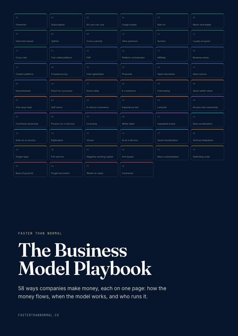
58 business models, one visual page each: how the money flows, the metrics that matter, and who runs it. Free when you join the Faster Than Normal email.
Free. No spam. Unsubscribe anytime.
Part IIIQuotes and Maxims
In their words
— Jack Dangermond, to The Irish TimesI'm the luckiest guy in the world because I get to glimpse into virtually every activity that humans are doing.
— Jack Dangermond, to xyHt, 2020I make mistakes every day, but I compensate for those mistakes by quick checking with my colleagues and sometimes my "not colleagues." You can minimize and avert disasters by just constantly checking in; checking your decisions.
— Jack Dangermond, to ComputerworldCreating a product organized around geography. I don't think it was inevitable that geographic information systems would have come into being in the way they have… We didn't author the idea … but we commercialized it.
— Jack Dangermond, to Upstarts, 2025It's going all in on something, even if you're bad. What I chose as a profession, I went all in on, and I loved it.
— Jack Dangermond, to the Santa Barbara Independent, 2024The impact of that one map was that people became literate in the spread of the disease. It scared them, it allured them, it made them aware that it wasn't just in their hometown but that it was elsewhere and that it was moving every day.
For the fullest statement of his philosophy, in his own words and assembled with the help of the GIS community he built, see his first book, The Power of Where: A Geographic Approach to the World's Greatest Challenges, published by Esri Press in 2024 with a foreword by James Fallows.
Maxims
- More money in than out. The first law of business is a nursery's law, and most founders forget it before they've opened the doors.
- Your customers will tell you what you are. Esri became a software company because eleven clients in a Redlands room demanded it, not because its founders planned it.
- Crude and indispensable beats polished and optional. If people keep using a product they complain about, you've found demand ahead of quality.
- Capital is an employer. Every investor brings a clock, and the freedom to do the right thing is mostly the freedom to ignore someone else's.
- Fund the future as a tax. R&D that is renegotiated every year will eventually be cut; R&D fixed as a share of revenue compounds for decades.
- Grow no faster than you can remain yourself. A ceiling on growth is a floor under loyalty.
- Sell the method, not the side. A way of thinking that any user can adopt will outlast any tool that takes a position.
- Everyone is an advisor. Chronic self-doubt, channeled into constant checking, is a better guardrail than confidence.
- Build depth where giants build breadth. The larger platforms will integrate with the layer they cannot cheaply replicate.
- Find something you really like to do, then figure out how to go to work there. Fifty-seven years in one field, in one town, is not a lack of ambition but its most concentrated form.


